
GIS

Overview
With cutting-edge tools and a comprehensive understanding of spatial analysis, we support clients in the energy sector by delivering high-quality geospatial insights.
Whether you’re working on site selection, monitoring environmental impacts, or planning infrastructure, we bring clarity and precision to complex spatial data, ensuring projects progress smoothly while mitigating risk, enhancing compliance and supporting sustainable outcomes.
What we do
With a team of specialists and vast knowledge of the energy sector, we leverage powerful GIS tools and techniques, to turn complex geospatial data into actionable insights that inform planning, compliance, and adaptive management.
Why us?
We’re experts in GIS technologies with a deep understanding and impressive track record of environmental and regulatory approaches. Our collaborative approach ensures that every project benefits from the most accurate, reliable, and actionable geospatial insights.
We help clients reduce risks, enhance compliance, and make more informed decisions throughout their project lifecycle.
Energy expertise
We’re specialists in energy, so our GIS work is grounded in a real-world understanding of project needs, constraints, and regulatory requirements. We know how energy projects move from concept to operation, and we provide insights using our GIS capability to support that journey.
Compliance-ready
Our spatial data and analyses are crafted with approvals in mind. We tailor outputs to meet environmental assessment and regulatory requirements, saving time during reviews and reducing the risk of delays or costly rework.
More than maps
From visualising constraints and sensitive habitats to evaluating feasibility and identifying risks, our insights provide the backbone to assess options, prioritse action and inform decisions.
Integrated capability
Our GIS solutions connect seamlessly with environmental monitoring programs, remote sensing tools, and field data collection systems. We integrate real-time into centralised spatial platforms to support adaptive management and timely interventions.
Clear insights
Our maps, models, and reports are designed to communicate complex information clearly to technical and non-technical audiences alike. Whether it’s for internal briefings, regulatory submissions, or public consultation, our visuals bring data to life in a way that is meaningful for your project.
What we've done
Our GIS team has supported a wide range of energy and infrastructure projects with clear, decision-ready spatial insights.
From environmental constraints mapping to site layouts, flood modelling, and impact assessments, we turn complex geospatial data into tools that drive better planning, compliance, and project delivery.
Our Achievements
Environmental & Constraints Mapping
Detailed maps of protected areas, habitats, and sensitivities to identify regulatory risks.
Site Layouts & Regional Context Plans
Scaled diagrams showing infrastructure placement, land disturbance zones, and rehabilitation areas within the broader landscape.
Geospatial Data Management
Curated library of government and custom spatial datasets (shapefiles, rasters) for accurate, up-to-date analysis.
Spatial Analysis & Hotspot Identification
Geocoding, trend analysis, and hotspot mapping (e.g., species clusters) to guide decision-making.
Water & Flood Impact Modelling
Watershed delineation, floodplain mapping, and scenario simulations for risk mitigation and water management.
Asset & Infrastructure Mapping
Location-based tracking of leases, wells, pipelines, and other assets relative to environmental constraints.
Desktop Environmental Impact Assessments (EIAs)
Spatial overlays of project footprints and ecological values to streamline approvals and stakeholder reviews.
Site Suitability & Risk Assessments
Multi-criteria evaluations (e.g., slope stability, biodiversity offsets) to flag high-risk zones or optimal project areas.
Clear Visual & Decision Support Tools
Interactive maps, dashboards, and plain-language summaries to translate technical data into actionable insights.
- Achievement item
Lorem ipsum dolor sit amet, consectetur adipiscing elit. Ut elit tellus, luctus nec ullamcorper mattis, pulvinar dapibus leo.
- Achievement item
Lorem ipsum dolor sit amet, consectetur adipiscing elit. Ut elit tellus, luctus nec ullamcorper mattis, pulvinar dapibus leo.
End-to-end project lifecycle support

GIS analysis and mapping

Corridor and constraints analysis

Remote sensing and image detection

Environmental monitoring integration

Remote sensing and image detection
Our Core Services
We leverage advanced spatial tools to generate clear, visually compelling maps that help stakeholders easily understand complex data. Our maps are essential for site selection, environmental constraints, and habitat delineations, ensuring that decision-makers can see the big picture at a glance.
Key applications include:
- Site selection and feasibility studies
- Environmental constraint mapping
- Habitat and ecosystem delineation
- Visual communication of geospatial data for non-technical audiences
We specialise in collecting, organising, and maintaining comprehensive geospatial datasets, including topography, sensitive habitats, and cultural heritage features.
Our robust spatial data management practices ensure
data accuracy and accessibility, enabling informed decision-making at every stage of the project lifecycle.
Key services include:
- Data collection and processing
- Data quality assurance and validation
- Database design and maintenance
- Spatial data analysis and reporting
Using GIS, we identify optimal routes and locations for pipelines, roads, and other infrastructure, balancing environmental sensitivities, engineering constraints, and legislative requirements. Our analysis supports clients in selecting the most efficient and sustainable routes while minimising environmental impact.
Key services include:
- Corridor optimisation for linear infrastructure projects
- Environmental sensitivity and constraint mapping
- Regulatory compliance assessments
- Stakeholder mapping and consultation support
We integrate field data, such as water monitoring points and flora/fauna sightings, into GIS-based maps, providing real-time insights into project footprints and facilitating adaptive management. This enables timely responses to environmental changes, ensuring that projects remain compliant and minimise their impact on the surrounding environment.
Key services include:
- Integration of monitoring data with GIS tools
- Real-time environmental impact tracking
- Adaptive management recommendations
- Environmental impact reporting
We use drone imagery and remote sensing technologies to track land-use changes, vegetation health, and potential environmental impacts. This approach provides high-resolution, up-to-date insights that allow for proactive adjustments to minimise risk and enhance project compliance.
Key services include:
- Drone imagery for land-use and vegetation health monitoring
- Remote sensing data analysis for environmental assessment
- Change detection and impact forecasting
- Integration of remote sensing with GIS for comprehensive spatial analysis
GIS analysis and mapping
We leverage advanced spatial tools to generate clear, visually compelling maps that help stakeholders easily understand complex data. Our maps are essential for site selection, environmental constraints, and habitat delineations, ensuring that decision-makers can see the big picture at a glance.
Key applications include:
- Site selection and feasibility studies
- Environmental constraint mapping
- Habitat and ecosystem delineation
- Visual communication of geospatial data for non-technical audiences
Spatial data management
We specialise in collecting, organising, and maintaining comprehensive geospatial datasets, including topography, sensitive habitats, and cultural heritage features.
Our robust spatial data management practices ensure data accuracy and accessibility, enabling informed decision-making at every stage of the project lifecycle.
Key services include:
- Data collection and processing
- Data quality assurance and validation
- Database design and maintenance
- Spatial data analysis and reporting
Corridor and constraints analysis
Using GIS, we identify optimal routes and locations for pipelines, roads, and other infrastructure, balancing environmental sensitivities, engineering constraints, and legislative requirements. Our analysis supports clients in selecting the most efficient and sustainable routes while minimising environmental impact.
Key services include:
- Corridor optimisation for linear infrastructure projects
- Environmental sensitivity and constraint mapping
- Regulatory compliance assessments
- Stakeholder mapping and consultation support
Environmental monitoring integration
We integrate field data, such as water monitoring points and flora/fauna sightings, into GIS-based maps, providing real-time insights into project footprints and facilitating adaptive management. This enables timely responses to environmental changes, ensuring that projects remain compliant and minimise their impact on the surrounding environment.
Key services include:
- Integration of monitoring data with GIS tools
- Real-time environmental impact tracking
- Adaptive management recommendations
- Environmental impact reporting
Remote sensing and image detection
We use drone imagery and remote sensing technologies to track land-use changes, vegetation health, and potential environmental impacts. This approach provides high-resolution, up-to-date insights that allow for proactive adjustments to minimise risk and enhance project compliance.
Key services include:
- Drone imagery for land-use and vegetation health monitoring
- Remote sensing data analysis for environmental assessment
- Change detection and impact forecasting
- Integration of remote sensing with GIS for comprehensive spatial analysis
Related Projects
Lorem ipsum dolor sit amet, consectetur adipiscing elit. Ut elit tellus, luctus nec ullamcorper mattis, pulvinar dapibus leo. Lorem ipsum dolor sit amet, consectetur adipiscing elit. Ut elit tellus, luctus nec ullamcorper mattis, pulvinar dapibus leo.

Our Capabilities
inGauge brings unparalleled expertise across well engineering, environmental compliance, and lifestyle project delivery.
Learn more
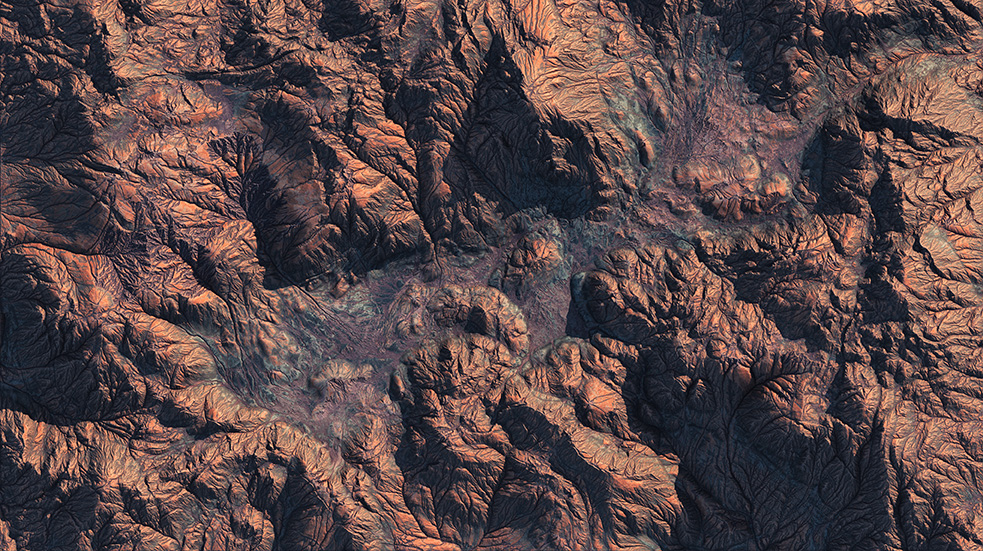
Beetaloo Basin, NT
At the frontier of Australia’s energy future.
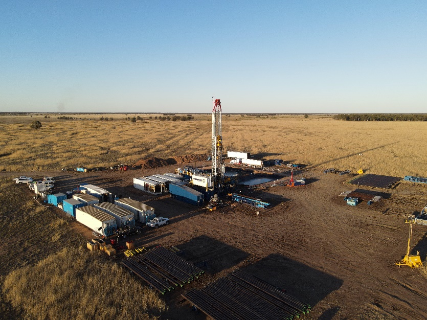
Taroom Trough
The team you need to deliver measurable results.
Decommissioning
Trusted by government and industry to decommission assets.
Alternative energy & emissions reduction
Leading alternative energy and emissions reduction projects.
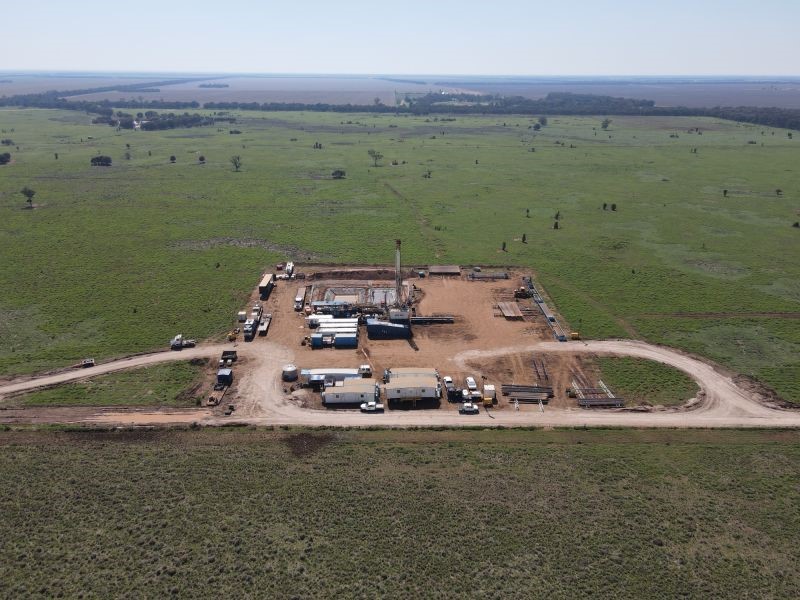
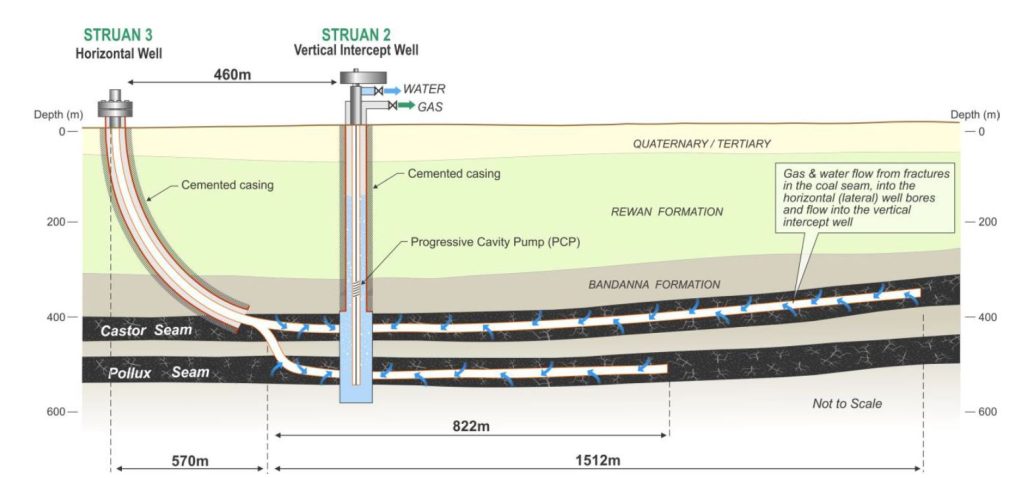
CSG
Decades of experience, thousands of wells, in every basin.